Aircraft Maximum Take Off Weight (MTOW) | 30.0 kg |
Endurance | +16 h (depending on carried payload) |
Datalink Range (C&C and Payload) | 100 km |
Rate of Climb (ROC) | 590 ft/min (3 m/s) |
Cruise Speed | 46 kts (23.7 m/s) |
Max Operational Altitude ASL (Above Sea Level) | 13000 ft (4000 m) |
Navigation Mode | Fully Automaticb y waypoints, or Semi-Automatic with Joystick/ Set Point |
Crew | 2 operators |
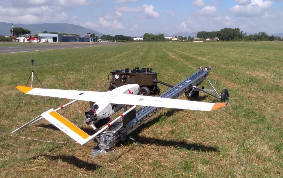
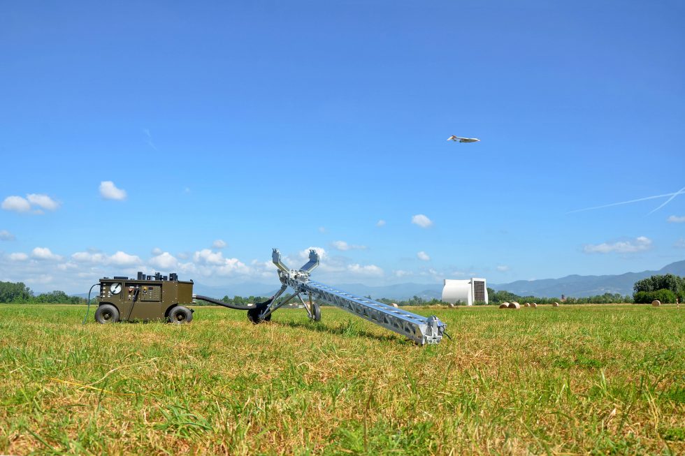
Deployment and packaging | <15 min |
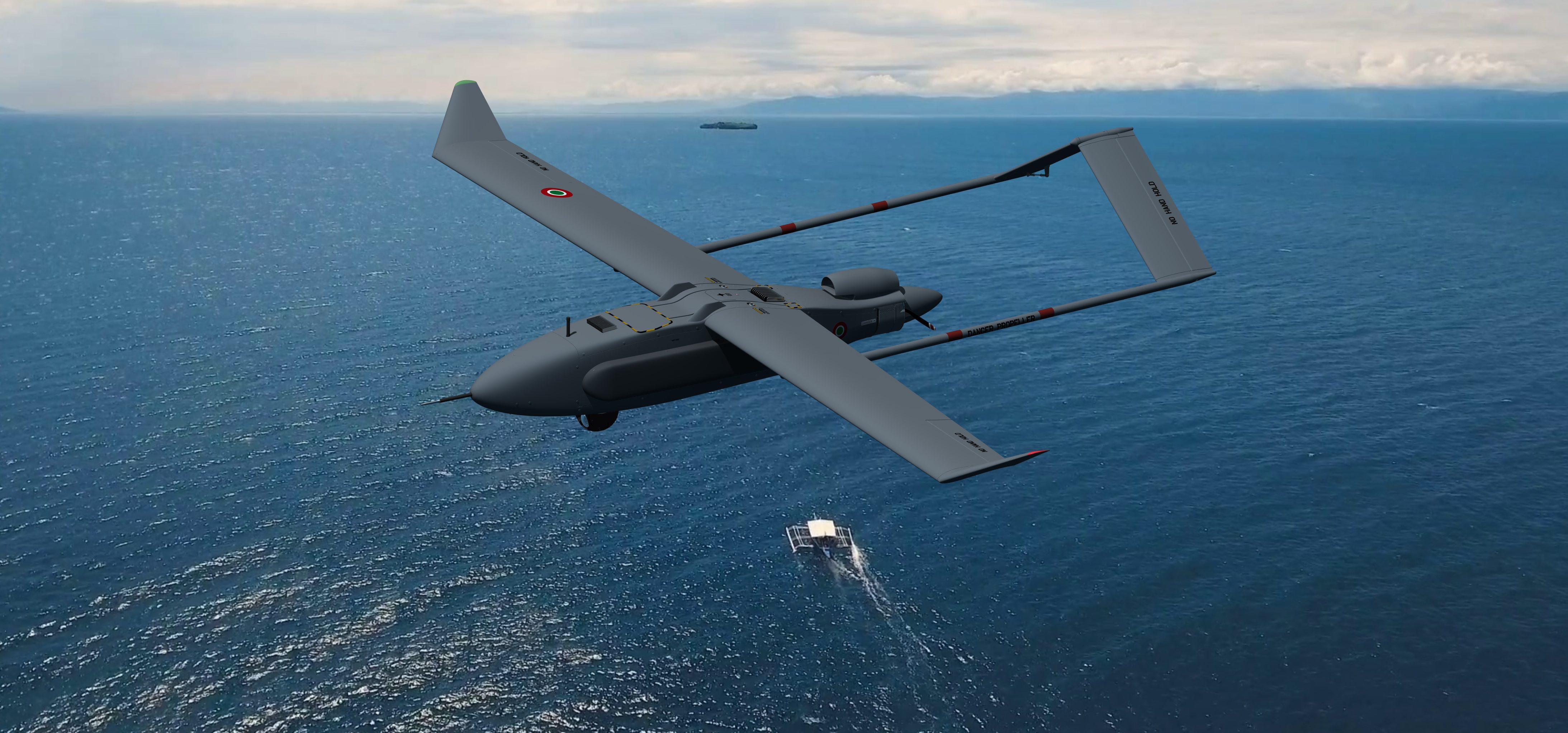
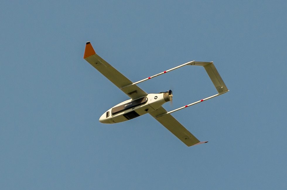
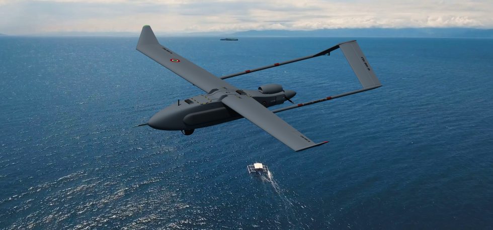
- Design The Rapier X-SkySAR has been designed according to strict aeronautical processes and standards, compliant with STANAG 4703, SAE AER. P-2-6-7 norms
- Multi-payloads The optimized aerostructure weight and layout volume, allows the Rapier X-SkySAR to carry dual payloads configuration: an EO/IR sensor together with the proprietary Synthetic Aperture Radar (SAR) sensor, for missions in degraded visibility (through smog, clouds…), sensor fusion and advanced post-processing
- ITAR free All Rapier family UAS are ITAR free, allowing for exportability all over the World
- Proprietary FCS and GCS FCS and GCS, developed in accordance with the Software Safety Critical DO178C DAL B, customizable according to Client’s specifications and cyber-attack resilient
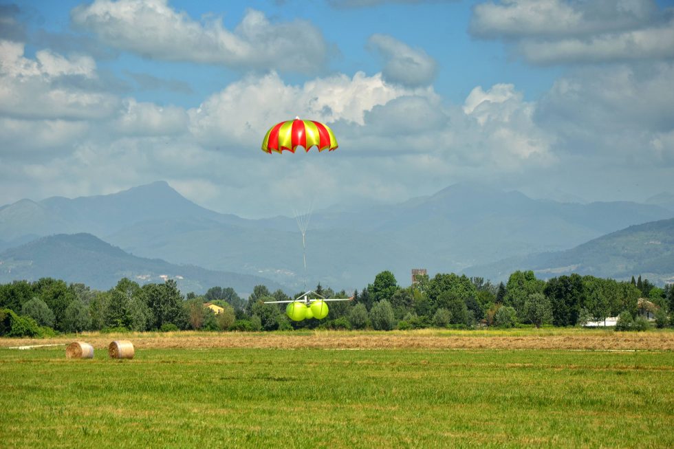
- Design for Supportability Straightforward setup up and mission operation, low logistic footprint. In addition, Sky Eye Systems can supply Integrated Logistic Support (ILS) and advanced operational training
The Rapier X-SkySAR has been designed to integrate several payloads with different features in terms of capabilities, weights and sizes. The flexibility is assured by the fuselage modularity and by the possibility to change the onboard systems configuration in order to obtain an optimized aircraft balance.
- Electro-Optical/Infra-Red Sensor The EO/IR sensor is the basic payload which allows ISR mission to be carried out. The Rapier UAS offers the possibility to choose between two types of EO/IR sensors: the basic one (two sensors day/night) and the high-performing one (four sensors day/night, with additional laser designator and range finder) with the best Detection, Reconnaissance, Identification performance of the category
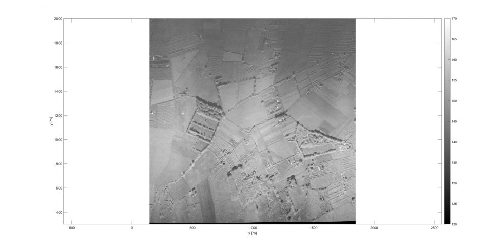
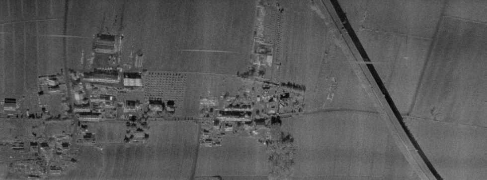
- Synthetic Aperture Radar A SAR sensor can improve the mission effectiveness, allowing for all-weather surveillance, control and data sensing, including Change Detection and Ground Moving Target Indication (GMTI) capabilities in ISR missions, or detect Oil Spill and Pollution in civil applications. The Sky Eye Systems proprietary mini SAR can provide accuracy of about 25 cm, slant range about 5-6 km and ground swath about 4 km. The overall radar system weight, less than 2kg, is minimized in order to guarantee long endurance
- LiDAR Low weight LiDAR, with power consumption similar to SARs, guarantees an accuracy of few centimetres. The ranges are lower than SAR ones (3-4 km), but such device allows ISR capabilities, Situation Awareness, Sense and Avoid, 3D mapping to be carried out
- Multi/Hyperspectral cameras This type of camera allows for specific missions (e.g. Change Detection, Anti Camouflage, Terrain Characteristics, Fire Detection, Agricultural Monitoring) to be performed, by means of images analysis and comparison gathered at different wavelength
- Transmitter Possibility to perform a Radio Relay by using the platform as bridge between ground units and command stations, thanks to a dedicated transmitter installed onboard
The Rapier X-SkySAR is suitable both for military and civil/governmental operational use.
Thanks to its features, Rapier X-SkySAR is the perfect solution for Intelligence Surveillance and Reconnaissance (ISR) military mission: the situational awareness requires real-time smart information, relative to a specific field of operations affecting terrestrial and maritime threats, in order to guarantee a prompt answer to potential attacks.
Military missions:
- Intelligence Surveillance Reconnaissance (ISR) Information acquisition for intelligence operations on specific targets (Example: Pattern of Life)
- Route Clearance For safe communication routes, in order to guarantee the armed forces transfer
- Force Protection Continuously monitoring and control of military installations to support forces deployed on the field
- Targeting: Teaming operation, the UAS laser designator locks on the target, enabling the manned aircraft, or helicopter, to hit it safely
- Change Detection and Ground Moving Target Indicator (GMTI) To detect relatively little changes on ground (buildings, terrain…), or to detect and track moving targets on the ground
Rapier X-SkySAR can also support other relevant civil missions, thanks to the possibility to install several on board payloads such as Hyperspectral or LiDAR, respectively needed for: ground mapping (farming, burned areas, mineral areas, and areas with potential environmental impact); geology, seismology, disaster monitoring.
Civil missions:
- Land surveillance Environmental information acquisition, maps production and illegal building detection, precision agriculture
- Law Enforcement Surveillance and protection activities, anti-looting, anti-piracy, illegal trades, territory and boundary control against immigration and terrorism
- Anti-pollution Oil-spilling control, illegal landfill, illegal waste disposal, ground and atmospheric pollution, forest fires
- Safety, public order and civil protection Environmental monitoring actions to reduce damages on community due to high magnitude accidental events (natural calamities, earthquakes, floods, etc)